|
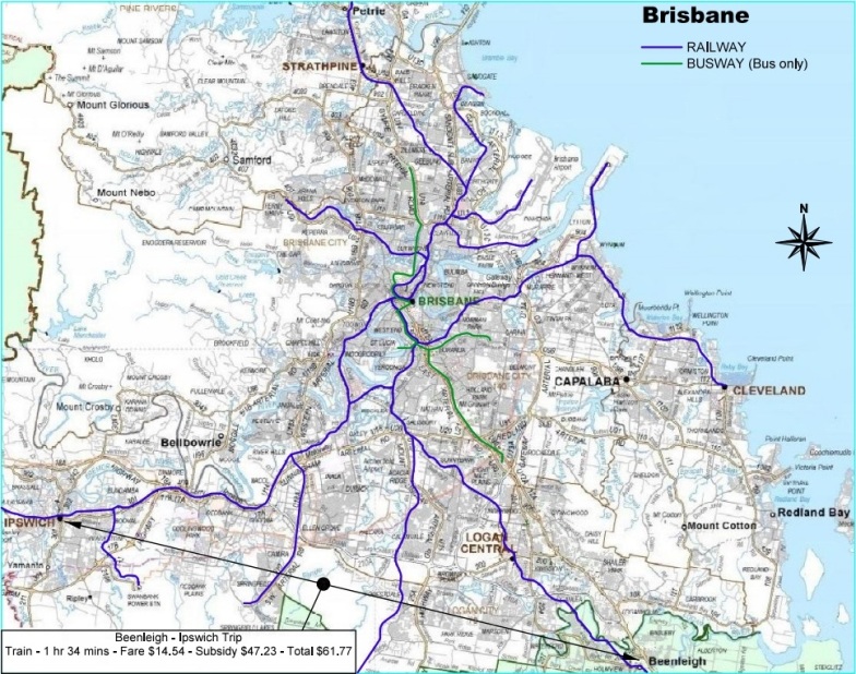
Brisbane Public TransportExisting Public Transport Network:-The map below shows the current rail and rapid bus layouts in the Greater Brisbane area. Typically, public transport systems radiate from city centres like the spokes of a wheel as is evident on this map. This was fine for the population densities we had a century ago when many of these railway systems were first constructed. We also had city areas which were then much smaller than they are today. The result is passenger congestion in the city centre which will only get worse as populations increase. These city centres are highly developed which creates challenges in augmenting these systems. As shown on this map, there is only one rail link over the river from the south into the Brisbane CBD. The Queensland Government is currently considering a new rail/bus tunnel, the "BaT project", to provide another link from the south into the city centre. The current estimated cost of this project is $5.0 billion.
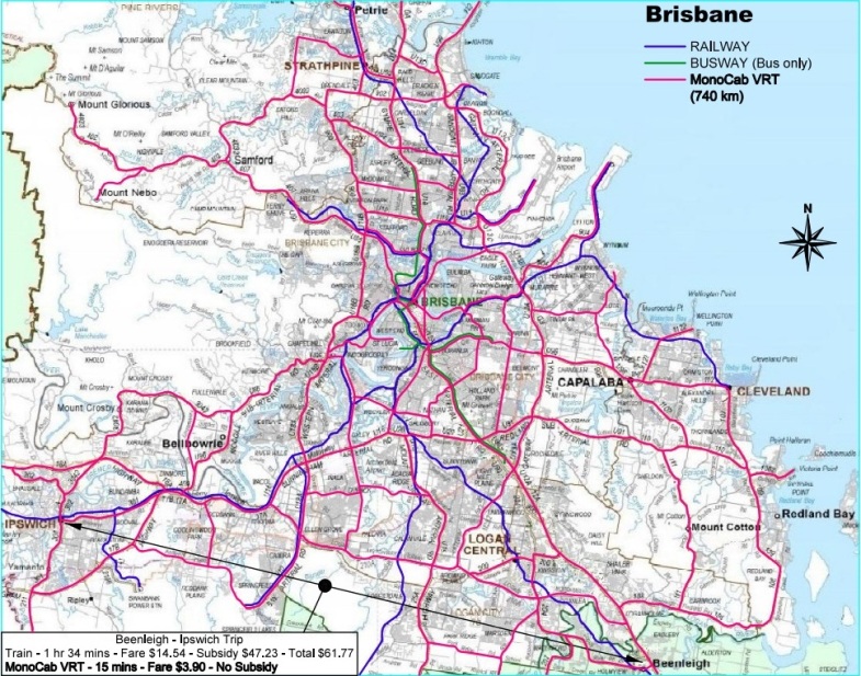
Brisbane MonCab VRT Network:-Proposed Network - 740 km:-The map below shows the proposed MonoCab VRT track layout for the Greater Brisbane area. There would be approximately 900 stations and mini stations on this network. Typical spacing of these stations would be approximately 800 metres. This 740 km layout would cost approximately the same as the proposed BaT project. Please take note of the caption in the bottom left corner of this map. For the journey as indicated, a Beenleigh based, rail passenger would travel to the Roma Street station in the Brisbane CBD and then transfer to another train to go to Ipswich. There are no trains available between 1:00 am and 4:00 am. This MonoCab VRT passenger would travel via a track along the Logan Motorway, most likely in a MonoCab VRT Mini car, with no restriction as to the time of day.
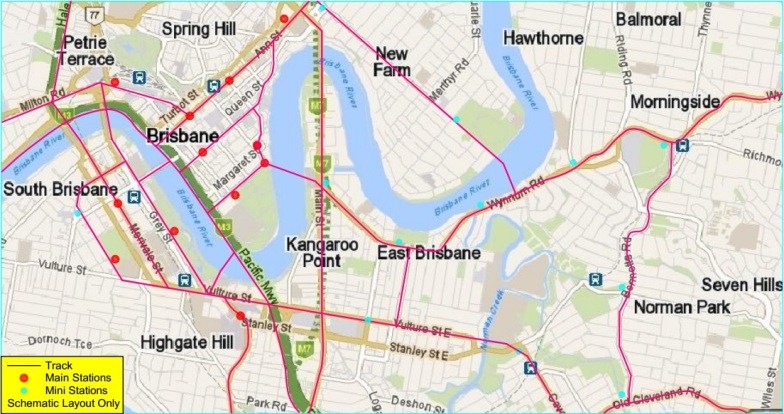
Brisbane CBDA Typical Example:-This map shows a POSSIBLE layout of the Brisbane CBD network as an example. You will note there are several stations throughout the CBD and several track options for travel in and out of the CBD. These will distribute passenger flow instead of concentrating all passengers into two locations (Roma Street and Central stations) as happens currently. These will be elevated stations built above streets and parks. Hence, they will not interrupt existing traffic and pedestrian flows. There is also the option of raising the track in this area to include walk ways/cycleways. This would allow pedestrians and cyclists safe, fast, easy movement around the CBD without having delays at traffic lights.
|
|
During public displays of our MonoCab VRT model, we conduct a written survey (name, address and comments). We
also ask respondents two questions:- The Response:- |


